The first edition (also known as the Monaco Chart) took just 7 months to compile and was published in 1903. The lithoprinted maps were presented at the Paris Academy of Science in January 1904 and the Eighth International Geographical Congress held in Washington, D.C later in the year.
La compilation de la première édition (également connue en tant que Carte de Monaco) a nécessité seulement 7 mois avant sa publication en 1903. Les cartes à impression lithographique ont été présentées à l’Académie des sciences de Paris, en janvier 1904 et au huitième Congrès géographique international tenu à Washington, D.C plus tard au cours de cette même année.
La compilation de la première édition (également connue en tant que Carte de Monaco) a nécessité seulement 7 mois avant sa publication en 1903. Les cartes à impression lithographique ont été présentées à l’Académie des sciences de Paris, en janvier 1904 et au huitième Congrès géographique international tenu à Washington, D.C plus tard au cours de cette même année.
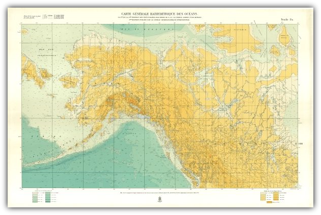
1st Edition (1903)

2nd Edition (1910 - 1930)
A major change of the second edition was the inclusion of land contours at the same interval as those shown for sea areas.
Un changement majeur dans la seconde édition a été l’inclusion de courbes de niveau terrestres à intervalle identique à ceux indiqués pour les zones maritimes.
Un changement majeur dans la seconde édition a été l’inclusion de courbes de niveau terrestres à intervalle identique à ceux indiqués pour les zones maritimes.

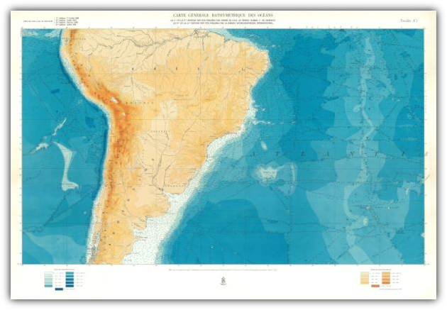
3rd Edition (1932 - 1966) only 21 sheets actually published.

The publication of the third edition was spread over a period of 34 years and only 21 sheets were published.
La publication de la troisième édition a été échelonnée sur une période de 34 ans et seulement 21 feuilles ont été publiées.
La publication de la troisième édition a été échelonnée sur une période de 34 ans et seulement 21 feuilles ont été publiées.
Work on the fourth edition commenced in 1958, before the third edition had actually been completed. Two sheets published in 1958 and 1961 were the last to be prepared by the IHB. In 1965 the French Institutgeographic National (IGN) took over the responsibility for the compilation, printing and sales of the GEBCO maps. Four sheets of the 4th edition and three of the 3rd edition were published between 1966 and 1973.
Les travaux sur la quatrième édition ont débuté en 1958, avant que la troisième édition ait réellement été terminée. Les deux exemplaires publiés en 1958 et en 1961 ont été les derniers à être préparés au BHI. En 1965, l’institut géographique national (IGN) français a repris la responsabilité de la compilation, de l’impression et des ventes des cartes de la GEBCO. Quatre exemplaires de la 4ème édition et trois de la 3ème édition ont été publiés entre 1966 et 1973.
Les travaux sur la quatrième édition ont débuté en 1958, avant que la troisième édition ait réellement été terminée. Les deux exemplaires publiés en 1958 et en 1961 ont été les derniers à être préparés au BHI. En 1965, l’institut géographique national (IGN) français a repris la responsabilité de la compilation, de l’impression et des ventes des cartes de la GEBCO. Quatre exemplaires de la 4ème édition et trois de la 3ème édition ont été publiés entre 1966 et 1973.
4th Edition (1958 - 1973)

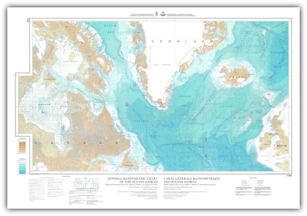
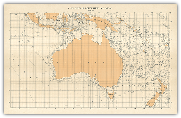
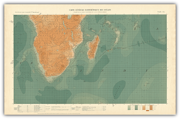
In 1973 a joint committee of the IHO and Intergovernmental Oceanographic Commission (of Unesco), took over the production of the fifth edition. An important innovation of this edition was the inclusion of sounding control on the face of each sheet. Discrete soundings appear as grey dots and echo-sounding tracks as grey lines in the background. The 5th Edition was completed in 1982.
En 1973, un comité mixte de l’OHI et de la Commission océanographique intergouvernementale (de l’Unesco), a été chargé de la production de la cinquième édition.
LUne innovation importante de cette édition a été l’introduction d’un contrôle des sondes sur chaque page. Les sondes isolées sont représentées par des points gris et les routes des sondeurs acoustiques par des lignes grises en arrière-plan. La 5ème édition a été terminée en 1982.
5th Edition (1973 - 1982)
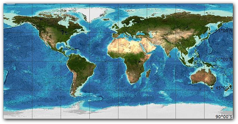
GEBCO's latest data set is the GEBCO_2014 Grid - a global terrain model at 30 arc-seconds. The grid is based on a database of quality-controlled ship-track soundings with interpolation between soundings guided by satellite-derived gravity data. Where they improve on this model, data sets generated by other methods are included. The grid can be downloaded from the internet: www.gebco.net/data_and_products/gridded_bathymetry_data/. Further details about the development of the data set can be found in the accompanying documentation.
GEBCO's New Generation of Products and Services
Since the early 1990s, GEBCO has moved to producing and making available digital bathymetric data sets products. Initially, the bathymetric contours from the GEBCO 5th Edition paper chart series were digitised and used in the generation of the GEBCO Digital Atlas (GDA). This CD-ROM product was first released in 1994 and contained a digital version of GEBCO’s bathymetric contour data set along with trackline control, undersea feature name and coastline information plus data viewing and access software.
Recognising the importance of the availability of gridded bathymetric data sets for applications such as ocean modelling work, GEBCO released its first global bathymetric grid, the GEBCO One Minute Grid, in 2003. This data set is at one arc-minute intervals and is largely based on the bathymetric contours contained within the GDA.
Recognising the importance of the availability of gridded bathymetric data sets for applications such as ocean modelling work, GEBCO released its first global bathymetric grid, the GEBCO One Minute Grid, in 2003. This data set is at one arc-minute intervals and is largely based on the bathymetric contours contained within the GDA.
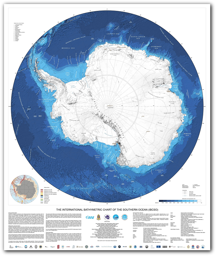
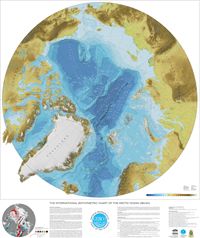
In polar regions, GEBCO’s global gridded data set benefits from the inclusion of regional mapping projects, i.e. the International Bathymetric Chart of the Arctic Ocean (IBCAO) and the International Bathymetric Chart of the Southern Ocean (IBCSO). These regional projects make available printable maps for download based on their digital bathymetric models.
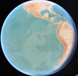
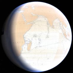
This site contains the five editions of GEBCO printed charts that were produced between 1904 and 1982, as downloadable graphics.
Ce site contient, sous forme de graphiques téléchargeables, les cinq éditions de cartes imprimées de la GEBCO qui ont été produites entre 1904 et 1982.