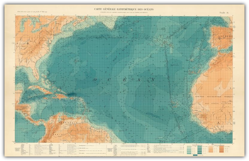
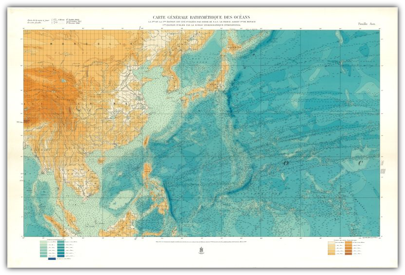
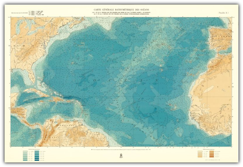
Sheet A 'I (S)
Sheet A I (N)
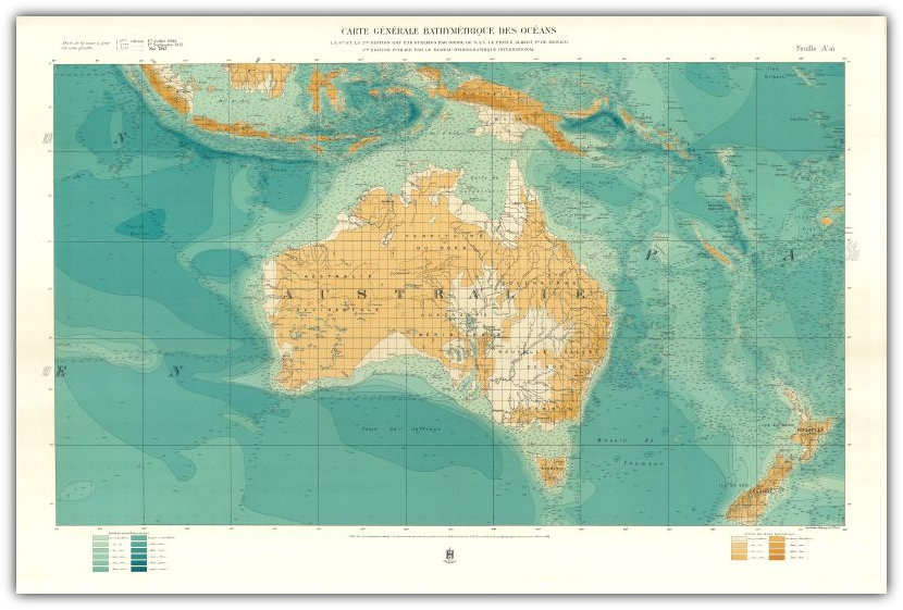
Sheet A II (N)
Sheet A 'II (S)
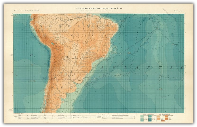
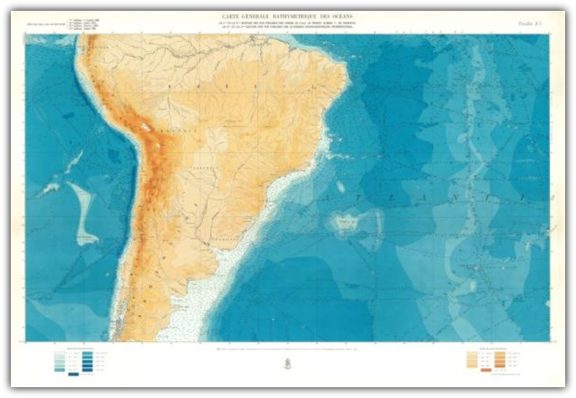
Sheet A III (N)
Sheet A 'III (S)
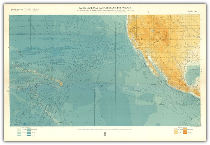
Sheet A IV (N)
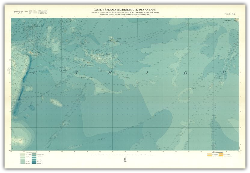
Sheet A 'IV (S)
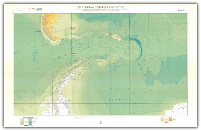
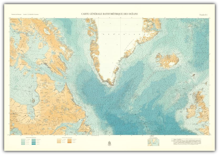
Sheet B I (N)
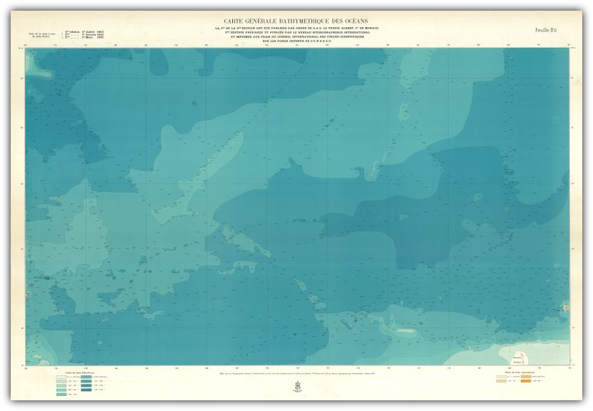
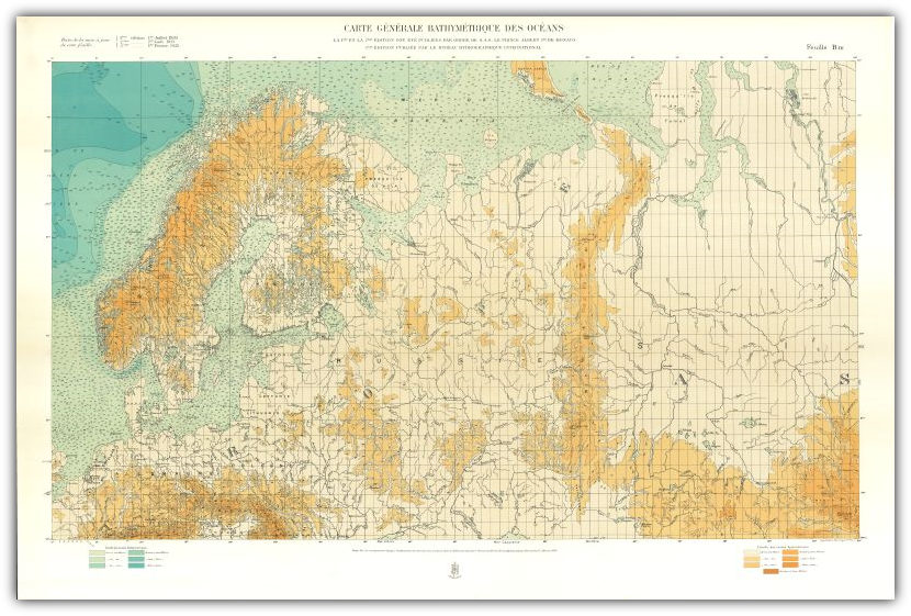
Sheet B 'I (S)
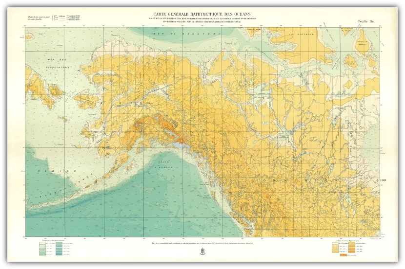
Sheet B II (N)
Sheet B 'II (S)

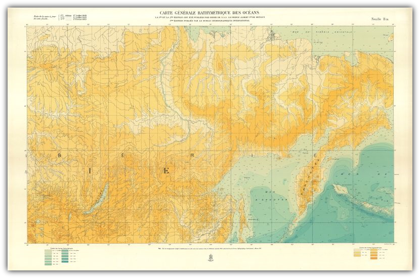
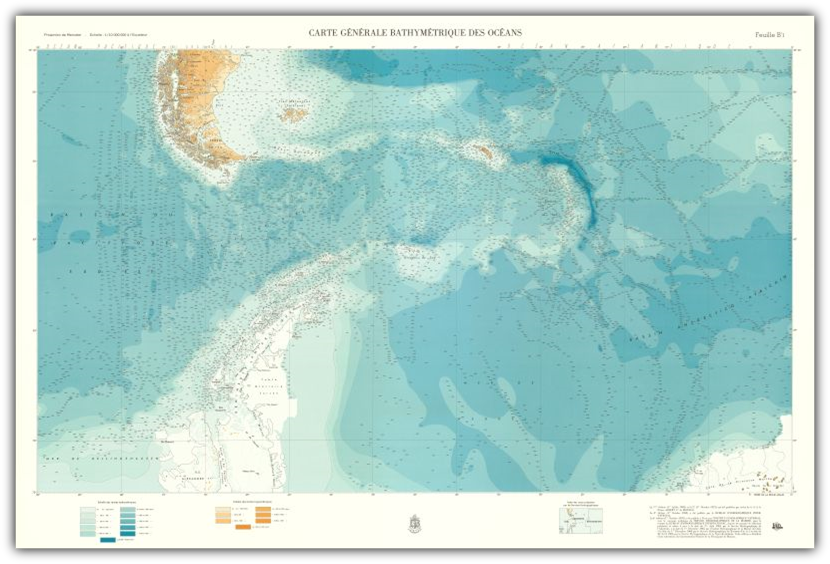
Sheet B- III (N)
Sheet B 'III (S)
Sheet B IV (N)
Sheet B 'IV (S)
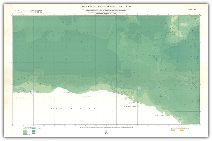
Sheet C I (N)
Sheet C 'I (S)
Sheet C II (N)
Sheet C 'II (S)
Sheet C III (N)

Sheet C 'III (S)


Sheet C IV (N)
Sheet C 'IV (S)
English
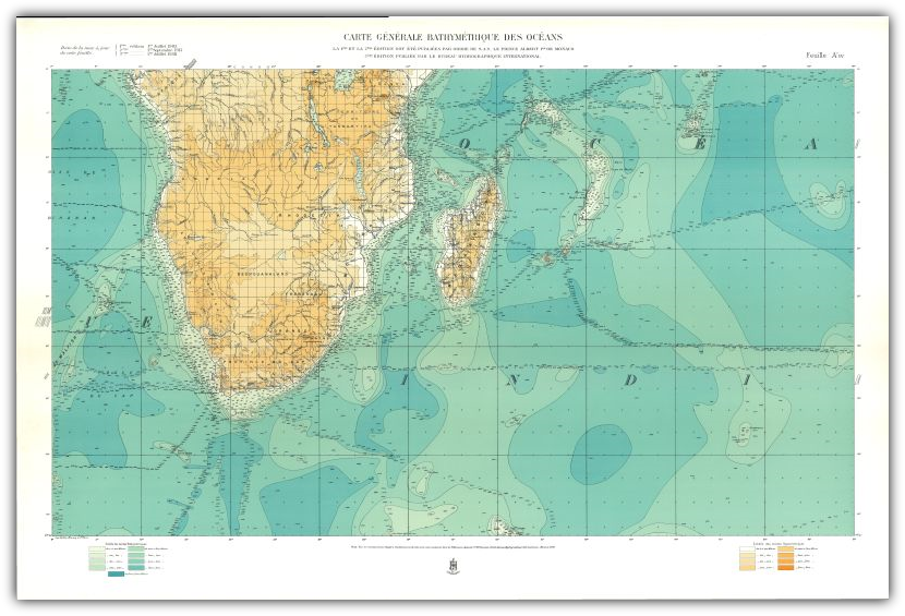
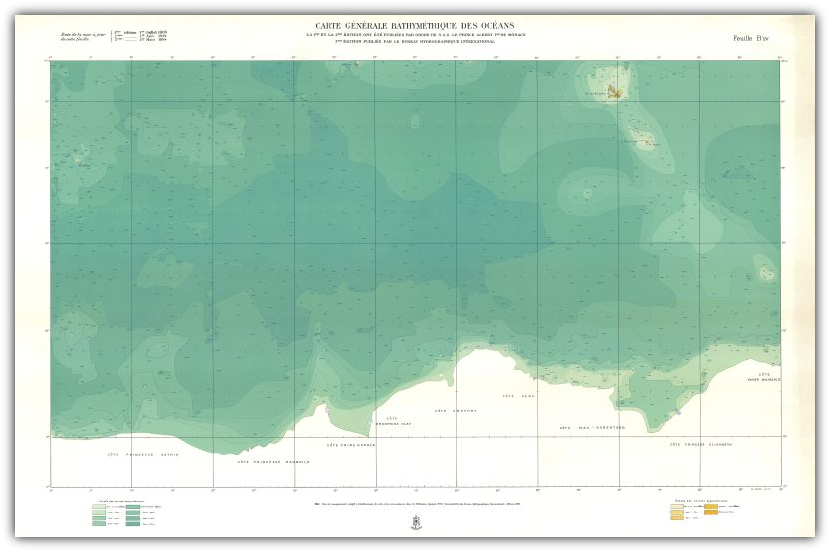
On the occasion of the inauguration of the Oceanographic Museum at Monaco in 1910, Prince Albert called together an international committee of experts to discuss the guiding principles to be followed for the second edition. The major change that emerged from these discussions was the decision to include land contours at the same intervals as those shown for the sea areas.
The first sheets were published in 1912 but the last did not appear until 1930. World War I broke out at a time when only a part of the series had been printed. Following the death of Prince Albert in 1922, Dr. Jules Richard, Director of the Oceanographic Museum at Monaco, supervised the production of the remaining sheets of the series in conformity with the wishes expressed in the Prince's will.
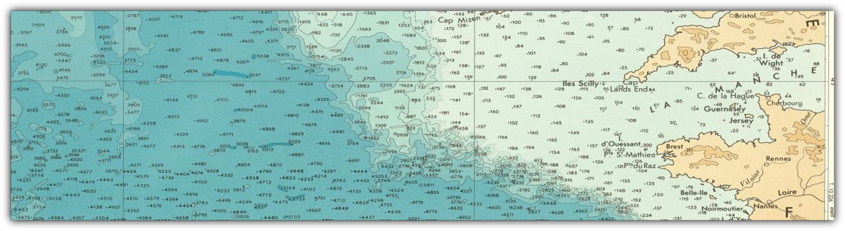
The cartographic style remained the same, but the number of soundings increased to 30000. More place names were shown than on the first edition. The principle addition was the inclusion of contours on land.
Dr. Richard, writing in 1930, makes a good assessment of the prevailing knowledge of the ocean floor: "The second edition (1912-1930) which has just been completed, is much more complete than the first. The general outlines of the relief of the land have been inserted under the direction of Professor Emm de Margerie ..... “The assembled coloured sheets form a magnificent chart of unique type. It is particularly interesting as an ensemble; it shows up in a striking fashion the gaps in our knowledge of the relief of the sea bottom. It shows us clearly what has yet to be done to fill these gaps”.
The first sheets were published in 1912 but the last did not appear until 1930. World War I broke out at a time when only a part of the series had been printed. Following the death of Prince Albert in 1922, Dr. Jules Richard, Director of the Oceanographic Museum at Monaco, supervised the production of the remaining sheets of the series in conformity with the wishes expressed in the Prince's will.
The cartographic style remained the same, but the number of soundings increased to 30000. More place names were shown than on the first edition. The principle addition was the inclusion of contours on land.
Dr. Richard, writing in 1930, makes a good assessment of the prevailing knowledge of the ocean floor: "The second edition (1912-1930) which has just been completed, is much more complete than the first. The general outlines of the relief of the land have been inserted under the direction of Professor Emm de Margerie ..... “The assembled coloured sheets form a magnificent chart of unique type. It is particularly interesting as an ensemble; it shows up in a striking fashion the gaps in our knowledge of the relief of the sea bottom. It shows us clearly what has yet to be done to fill these gaps”.